Shropshire - Minton Hill
Minton Hill Walk - By Alan Garner
This walk takes in a part of the Longmynd that is less popular – largely due to the availability of mass car parking spaces close to the hill.
Minton - The place name is from Welsh mynydd meaning 'hill' and Old English tun meaning 'settlement', 'town'. The hamlet has largely retained its Anglo-Saxon layout, with a patchwork of plots and haphazard narrow lanes. There are remains of a motte, which dates from either Anglo-Saxon or Norman times. It was a township and Royal manor, held by King Edward prior to the Norman conquest. It is mentioned in the Domesday Book.
Today the hamlet consists of farms and cottages and is agricultural in character. It is designated a conservation area and there are 5 Listed buildings in the hamlet – Long Mynd House, Ivanhoe, Manor Farmhouse, Well Cottage, and Minton House.
Minton Hill is to the northwest of the hamlet and rises to 453m. A bridleway leads up to its summit (and continues beyond onto the Long Mynd) from the hamlet of Minton. Another walking route up to the Long Mynd is via the Minton Batch, where a bridleway leads up from the lane to Hamperley.
The Oscar-nominated actor, Pete Postlethwaite, lived at Yew Tree Cottage in Minton for many years before moving to the village of More near Bishop's Castle. "I do love Shropshire," he was quoted as saying. "Whenever I get home, my shoulders drop by two inches. The only reason I’ve been able to do the things I’ve done is because I have my family and Shropshire to come home to. They’ve made everything else possible."
This walk actually starts in Little Stretton – a mile walk along the undulating quiet lane between this village and the hamlet of Minton. When you reach the green – turn right along it for 30 metres and keep going right past an ancient cottage, turning left round it. In front of you is Minton Hill. Proceed through the gate and for the next 400 metres it is a tough uphill grind.
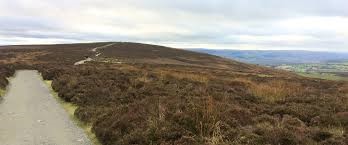
Track leading to the Portway
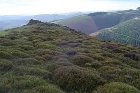
Eventually the footpath becomes a grassy track going upwards but steadily. You reach the rock that sticks out of the hillside – the Packetstone rock – and from here a lovely view over Minton Batch and the south end of the Longmynd. The hill is 453 metres high but as you are on a grassy high plateau there is no real summit.
Always keep right and the track- a bridle track becomes broad and easily followed.
One mile further on you meet the road that leads to the Midland Gliding Club, and to Asteron in the valley below. Turn right and you can keep to the grassy bank alongside the road. On your right is the valley of Callow hollow.
In front in the distance, you see the top of the Longmynd in front of you at 517 metres.
After a mile and a quarter walking, look out for a broad path on the right- this leads back in the opposite direction to the climb over Minton Hill. A grassy track – easy on the feet- leads over Barristers Plain and undulates with Ashes Hollow on the left and Callow Hollow on your right- lovely views all over the Longmynd and the further afield hills of Ragleth, Caer Caradoc and further east of the Clee Hills.
Eventually you reach the downward slope into Small Batch, and Little Stretton, crossing the stream at the bottom of the hill, over the footbridge and right into Little Stretton.
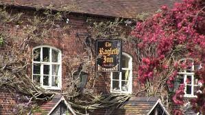
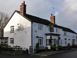
Here – excellent refreshment and meals at the villages two pub restaurants- the Ragleth Inn and the Green Dragon.
8 miles and an ascent and descent of 280 metres.
There is a thatched church also in the village.
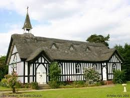
Thatched church Little Stretton
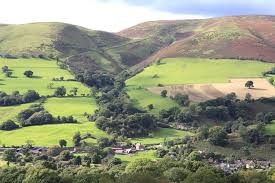
Small Batch - Little Stretton
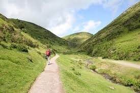
Ashes Hollow Little Stretton
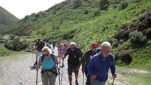
Walkers approaching Little Stretton